Best 3D Geo Analysis from SSAAR Geo Analyst
SSAAR Geo Analyst is a 3D geo analysis company transforming data into online mapping solutions to represent spatial relationships accurately. We provide 3D Geo Analysis services to the agriculture, sustainable energy, real estate, healthcare, tourism, transportation, and logistics trades. With 3D Geo Analysis, you can benefit from complex geospatial data visualization, accurate data, better decision-making, and partnerships with industry experts. So, don’t wait to use data-driven maps to meet your business needs.

SSAAR Geo Analyst is your trusted platform for 3D Geo Analysis.
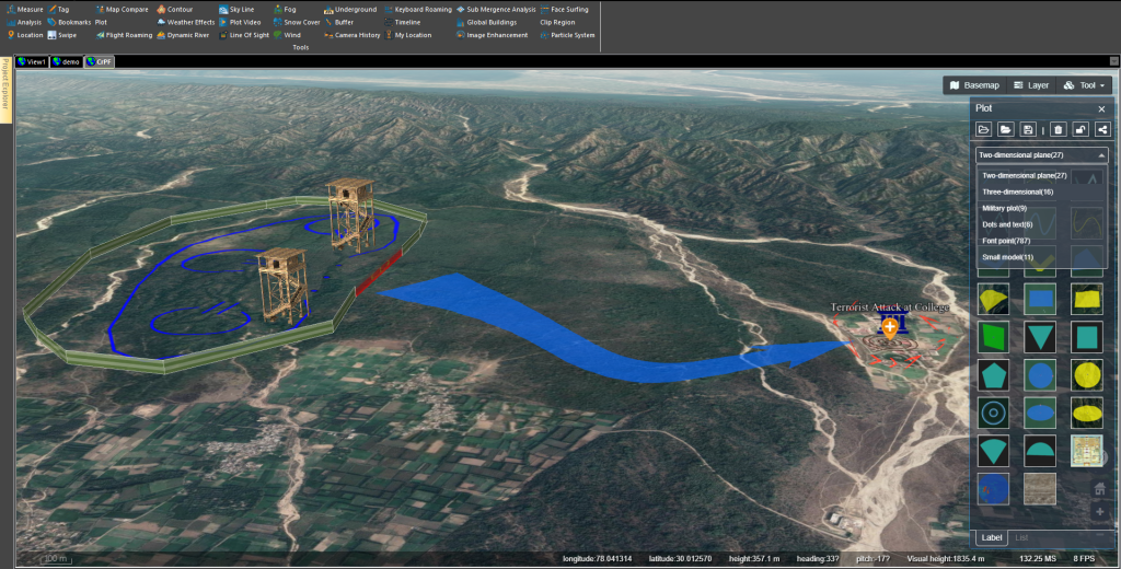
By compiling and combining data sources, checking and cleaning the data quality, and presenting it in a usable format, you get reliable 3d Geo analysis online you can trust and use. Maximize Project Results with SSAAR Geo Analyst 3D analysis, insights, and visualization information. It takes benefit of detailed 3D building models with color and texture information, rendered as separately selectable buildings over a inclusive terrain model. Our 3D Geo Analysis for various industries and use cases provides immersive experiences and accurate visual simulations to enhance your understanding of data and user engagement.
Save time and resources
You no longer need to search for the correct data or convert between formats. With us, you always have the data you need when needed.
Easy integration
No more hassle of searching, downloading, and converting data. Provides 3D geo analysis in a GIS-compatible format.
Data-driven decision making
Transform your decision-making process with valuable insights from comprehensive coverage of the built environment.
Impressive visualization
Impress your viewers with fabulous visual images of the built atmosphere with exact and accessible 3D geo analysis.
Reliable data with regular updates
Our 3D Geo Analysis quality checks and updates all data monthly, reducing the chance of errors, outliers, or missing information.
Maximize efficiency
Our cost-effective solutions save you time and resources so you can focus on what matters.
Value of building height
Added height information for all buildings to the database to provide more robust assets. Building height information is essential for 3D visualization but also for 3D topographic analysis.
It can also generate information such as line of sight and radio signal propagation. Global Heights combines various analytical approaches and machine learning to classify urban areas effectively.
Benefits of 3D Geo Analysis
There are many benefits of 3D Geo Analysis in India.
Accuracy
3D Geo analysis is a more accurate representation than 2D. Capture objects and environments in three dimensions. It allows you to obtain detailed information about an object’s shape, size, and spatial relationships. These specifications are helpful for a wide range of applications.
Visualization
With the help of 3D Geo analysis, objects, and environments can be presented more realistically and intuitively. Additionally, 3D models allow users to view objects from all angles, allowing users to understand better and visualize spatial relationships. It helps in planning, design, and analysis.
Information
3D Geo analysis allows you to get more information. 3D geo analysis allows users to obtain additional data and more detailed information. The additional information can be used to create realistic visualizations, measure quantities, and analyze material properties.
Automation
3D Geo analysis produces detailed and accurate maps of large areas with negligible human intervention. Additionally, 3D Geo Analysis provide more sophisticated and detailed spatial analysis with the capability to measure angles, distances, and volumes. This saves time and money related to traditional mapping and surveying methods.
Communications
3D geo analysis simplifies the communication procedure between experts from different industries. The results of 3D geo analysis make it easy to share ideas and information. Effective collaboration can help you increase productivity and achieve tremendous success.
Here’s what you get from3D geo analysis:
Increase Productivity with Automated Access
Automated, standardized access lets you save time and get the data you need anytime, anywhere, on any device.
Streamlined integration for seamless data usage
Get quick and easy integration with your existing data infrastructure to ensure everything works together smoothly.
Empowering developers
Developers rely on our 3D geo analysis for feature-rich and accurate building footprints, providing reliable support when needed.
Unleash the full potential of 3D architectural data
Transform your risk analysis, communication planning, and 3D reference models with accurate, data-driven insights.
Optimize your projects with 3D Geo analysis
Powerful 3D rendering and analysis with improved features, accurate polygons, and advanced geospatial data.
Increase collaboration and communication.
Provide your stakeholders a more immersive and interactive experience to improve collaboration and communication.
The SSAAR Geo Analyst team is committed to providing high-quality 3D geo analysis services and enabling clients to harness the power of geo through spatial data and the latest technology. Our customers’ priorities always come first. You are the boss of your project. Since we are a 3D Geo Analysis company in India, we have a vested interest in the success of your projects. We aim to exceed our customers’ expectations and always take a proactive approach to unlocking the insights of 3D geo analysis and creating the right solution for your business.
Frequently Asked Question's
The cost of 3D Geo analysis depends on several factors, including the project's complexity, the projected area's size, the level of detail required, and the event's location.
The main benefits of 3D Geo analysis services include an accurate and detailed digital representation of the environment, better visualization and analysis of complex spatial data, better decision-making, cost-effectiveness, increased efficiency, and better communication.
3D Geo analysis can be used in various industries, including urban planning, architecture, civil engineering, mining, construction, and cultural heritage.
